

Table of Contents:
- Introduction
- What Are Fire Hot Spots in California?
- Northern California Fire Hot Spots (Deep Dive)
- Southern California Fire Hot Spots (Deep Dive)
- Central California Fire Hot Spots (Deep Dive)
- The Science Behind Wildfire Risk
- Climate Change and the Expansion of Fire Hot Spots in California
- Human Activity and Wildfire Ignition
- The Wildland-Urban Interface (WUI) Explained
- Economic and Environmental Impact of Wildfires
- How Homeowners Can Reduce Risk
- Community-Level Prevention Strategies
- Frequently Asked Questions
- Conclusion
- Strong Call to Action – Eaton Fire
Introduction
California is one of the most wildfire-prone regions in the world, and in recent years, the scale and destruction of these fires have intensified dramatically. Entire communities have been devastated, thousands of homes have been destroyed, and billions of dollars in damages have been recorded annually.
At the center of this crisis are the fire hot spots in California regions that repeatedly experience high wildfire activity due to a dangerous combination of natural and human-driven factors.
Understanding these fire hot spots is no longer optional. Whether you are a homeowner, renter, investor, or business owner, knowing where the risks are highest and why can help you make informed decisions, protect your assets, and even save lives. With this context in mind, let’s explore the regions most at risk and what makes them vulnerable.
In this comprehensive guide, you’ll get an inside look at California’s most notorious fire-prone regions. We break down what fuels wildfire behavior and give you hands-on strategies to take control of your own risk.
What Are Fire Hot Spots in California?

- Prolonged dry seasons that turn vegetation into fuel
- Dense forests, brush, or grasslands
- Strong seasonal wind systems
- High temperatures and low humidity
- Proximity to human activity
Northern California Fire Hot Spots (Deep Dive)
Napa and Sonoma Counties
These iconic wine regions are also some of the state’s most wildfire-prone zones. Golden hills, dry grasslands, and sprawling vineyards weave together a fuel bed where wildfires can race unchecked.
Diablo winds accelerate flames and spread embers miles ahead. This was seen in the Wine Country fires, where whole neighborhoods burned overnight.
Butte County (Paradise Area)
among the most dangerous fire hot spots in California due to:
- Dense forest cover
- Limited evacuation routes
- Steep terrain that accelerates fire spread
Shasta County and Redding
Southern California Fire Hot Spots (Deep Dive)
Los Angeles County
Los Angeles is one of the most complex fire-prone areas in California because it combines dense population with highly flammable landscapes. Urban expansion into hillside areas has significantly increased exposure to wildfires.
When Santa Ana winds blow, wildfires can race across the landscape, leap major roads, and spark new blazes miles away. Entire neighborhoods can be caught off guard in a blink.
San Diego County
San Diego has a long history of devastating wildfires, including some of the largest in state history. The region’s dry chaparral vegetation acts as a powerful fuel source, and strong winds can turn small fires into major disasters within hours.
Every year, more families settle in harm’s way as the WUI stretches outward, putting new homes right in the wildfire crosshairs.
Ventura County
Central California Fire Hot Spots (Deep Dive)
Fresno and Sierra Nevada Foothills
Kern County
Santa Barbara County
The Science Behind Wildfire Risk
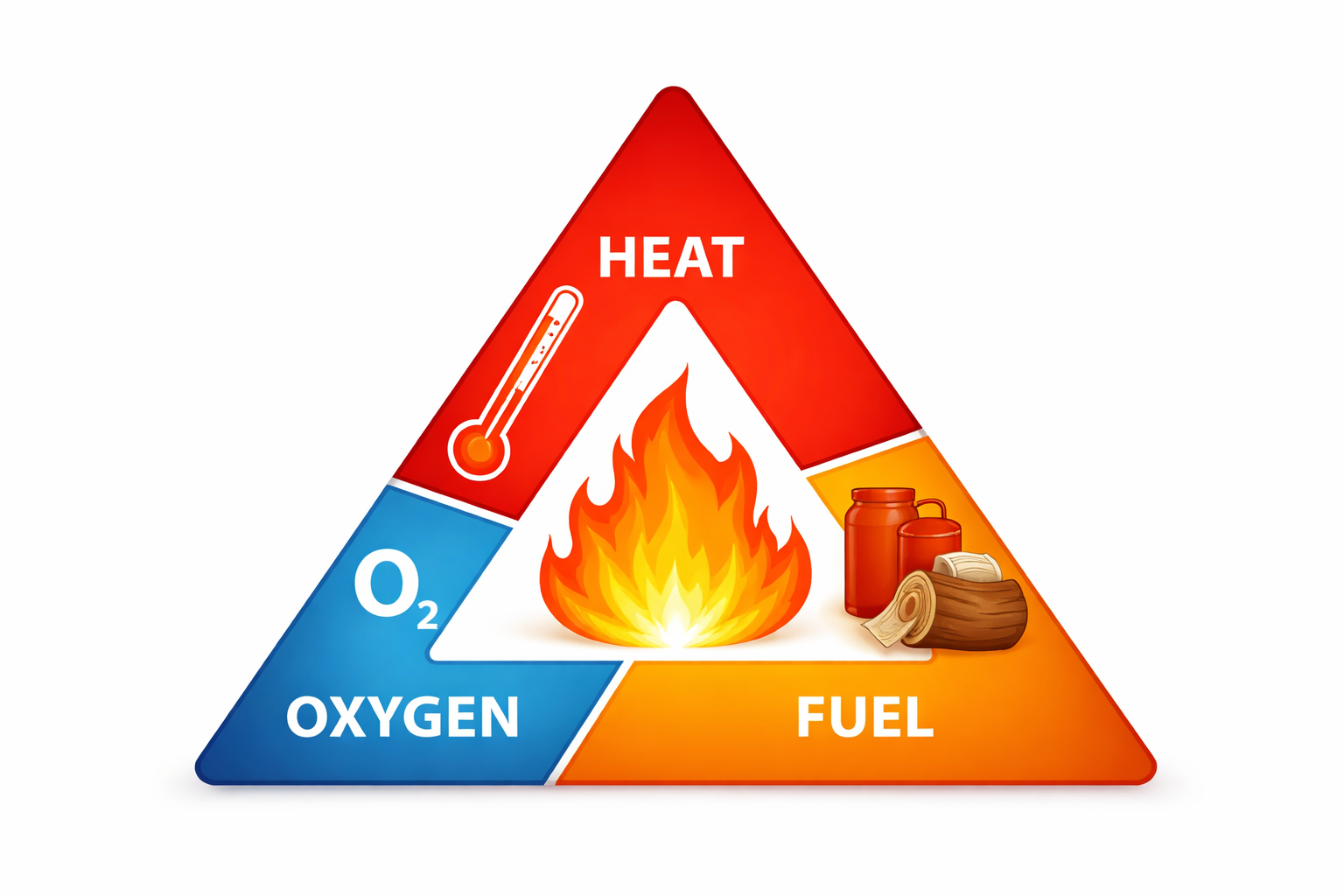
- Heat
- Fuel
- Oxygen
California provides all the elements of the fire triangle in abundance. But what sets fire hot spots apart is how these ingredients combine explosively, igniting disaster.
For example:
- Dense vegetation increases fuel availability.
- High temperatures provide ignition potential.
- Strong winds supply oxygen and spread flames.
Climate Change and the Expansion of Fire Hot Spots in California
Longer Fire Seasons
Increased Drought Conditions
Reduced Snowpack
Extreme Weather Events
Human Activity and Wildfire Ignition
Power Lines and Infrastructure
Campfires and Outdoor Activities
Equipment Use
Arson and Negligence
The Wildland-Urban Interface (WUI) Explained
The wildland-urban interface is one of the most important concepts when discussing fire hot spots in California.
This is where:
- Homes and communities meet natural vegetation.
- Fire risk is significantly higher.
- Emergency response becomes more complex.
Economic and Environmental Impact of Wildfires
Economic Costs
- Billions in property damage annually
- Increased insurance premiums
- Business interruptions

- Loss of wildlife habitats
- Air pollution and health risks
- Soil erosion and water contamination
How Homeowners Can Reduce Risk?
Create Defensible Space
Use Fire-Resistant Materials
Maintain Landscaping
Prepare an Emergency Plan
Community-Level Prevention Strategies
Controlled Burns
Infrastructure Upgrades
Public Awareness Campaigns
Frequently Asked Questions
2. Why are fire hot spots in California increasing?
3. Can wildfires happen year-round in California?
4. What is the biggest cause of wildfires in California?
5. How can I protect my home if I live in a fire hotspot?
Conclusion
The reality is clear: fire hot spots in California are expanding, intensifying, and becoming more dangerous each year. From Northern forests to Southern coastal hills, no region is immune to the growing threat of wildfires.
However, understanding these risks is the first step toward prevention. By staying informed, preparing your property, and taking proactive measures, you can significantly reduce your vulnerability.
Strong Call to Action – Eaton Fire
If you live in one of the many fire hot spots in California, now is the time to act, not after disaster strikes.

At Eaton Fire, we specialize in helping homeowners and communities prepare for, respond to, and recover from wildfire damage. Whether you need expert guidance, help navigating insurance claims, or immediate post-fire support, our team is ready to stand by your side.
Every moment counts when it comes to wildfire protection.
👉 Contact Eaton Fire today for a free consultation and take control of your safety, your property, and your future before the next wildfire hits.